
GGBC Natural Topography and Landscape
Natural topography and landscape planning are important components of sustainable building design because the way a site is developed can have a lasting effect on soil, vegetation, water movement, biodiversity, and the surrounding environment. Rather than treating the landscape as an element that is added after construction, sustainable site planning integrates existing natural features into the overall architectural and engineering strategy.
Natural topography refers to the existing physical characteristics of a site, including slopes, rock formations, natural depressions, water bodies, and other terrain features. Preserving these characteristics can reduce unnecessary excavation and filling, minimise disturbance to the site, and help maintain natural drainage patterns. A well-planned project should therefore begin with a detailed assessment of the existing terrain before determining building locations, access roads, parking areas, Natural Topography and landscape zones.
The approach to natural topography also supports biodiversity. Existing vegetation and natural ecological features can provide habitat for birds, insects, and other organisms. Where landscaping is required, the use of native or adaptive plant species is generally preferable because these plants are better suited to local climatic and soil conditions. Sustainable landscape planning should also avoid excessive monoculture, as diverse planting can provide greater ecological value.
A key consideration is the proportion of the site retained as natural topography and/or vegetated ground. The published green-building guidance for new buildings recognises retention of natural terrain and ground-level vegetation as a strategy for reducing long-term environmental impacts. Its criteria identify natural features such as exposed rocks and water bodies as examples of natural topography, while also emphasising native or adaptive vegetation and biodiversity.
Landscape design should additionally consider water efficiency. Excessive turf and ornamental plants that require frequent irrigation can increase water consumption. Instead, designers can combine drought-tolerant species, appropriate soil preparation, efficient irrigation systems, rainwater management, and permeable surfaces. These measures can help landscapes remain functional Natural Topography and attractive while reducing dependence on potable water.
Documentation is another important aspect of professional site planning. Landscape drawings should clearly identify retained natural features, vegetated areas, landscape pockets, and their respective areas. Photographic documentation of existing conditions can also establish how the site looked before development. Current green-building documentation guidance specifically highlights landscape drawings, area statements, photographs, and information regarding retained natural topography.
Ultimately, natural topography and landscape planning should be approached as an integrated part of sustainable architecture. Preserving the character of the site, protecting existing ecological features, selecting appropriate vegetation, and managing water responsibly can reduce environmental disturbance while creating healthier Natural Topography and more resilient outdoor spaces.
For additional technical reference, readers can consult the official resources for Green New Buildings rating guidance and Green Landscapes guidance. These resources provide further information on sustainable site planning, landscape design, water conservation, Natural Topography and environmental performance.
#SustainableConstruction
What Is Natural Topography and Why Is It Important in GGBC Site Planning?
Natural topography refers to the original physical characteristics and features of a site before construction or major land modification takes place. It includes the existing contours, slopes, terrain, exposed rocks, natural depressions, water bodies, and other geological or physical features that form the landscape. In sustainable site planning, the objective is not simply to prepare a flat plot for construction, but to understand the existing landform and incorporate it into the project wherever practical.
Natural topography is important because excessive alteration of a site can create significant environmental impacts. Large-scale excavation, filling, grading, and levelling can disturb soil, alter natural drainage patterns, remove vegetation, and affect existing habitats. Preserving portions of the original terrain can therefore help minimise the long-term environmental disturbance associated with development.
The GGBC approach to site planning places emphasis on retaining natural topography and/or providing vegetated ground areas. The relevant green-building criteria recognise natural features such as exposed natural rocks and water bodies as examples of natural topography. They also encourage the use of native or adaptive vegetation rather than monoculture planting because diverse vegetation can provide greater habitat and biodiversity benefits.
Another important benefit is improved stormwater management. Natural slopes and vegetated areas can help slow down surface runoff and allow more water to infiltrate into the soil. Maintaining these characteristics can reduce the need for extensive artificial drainage interventions and can contribute to better management of rainfall on the site. The approach can be particularly valuable on sites with significant slopes or naturally occurring drainage channels.
Natural topography can also improve the ecological value of a development. Existing trees, vegetation, rocks, water features, and other landscape elements may provide habitat for local species. Retaining these features, wherever feasible, helps maintain ecological continuity Natural Topography and can contribute to a more diverse and resilient landscape.
From a design perspective, respecting the existing terrain can also lead to more responsive architecture. Buildings, pathways, and outdoor spaces can be positioned according to the site’s contours rather than forcing the land into an entirely artificial form. This may reduce unnecessary earthwork while creating more distinctive and visually integrated landscapes.
The current green-building guidance for new buildings provides specific criteria for retaining natural topography and/or vegetated areas. For projects following the applicable version of the rating system, the required percentage and documentation should be checked against the version under which the project is registered. The official guidance also requires documentation such as site drawings and calculations demonstrating the area retained or vegetated.
In conclusion, natural topography is an important part of sustainable site planning because it helps reduce land disturbance, support biodiversity, manage stormwater, and preserve the ecological character of a site. Instead of viewing existing terrain as an obstacle to construction, professional site planning treats it as a valuable resource that can guide a more environmentally responsible development.
#EcoFriendlyDesign
How Can Preserving the Existing Topography and Landscape Reduce Environmental Impact?
Preserving the existing topography and landscape is an important sustainable site-planning strategy because it allows development to work with the natural characteristics of the land rather than completely modifying them. Existing slopes, natural contours, rocks, water bodies, mature vegetation, and other landscape features can provide valuable environmental functions. Retaining these features can reduce construction-related disturbance while supporting biodiversity, water management, soil stability, and the long-term ecological performance of a site.
One of the most significant benefits is the reduction of earthwork and site disturbance. Conventional development may involve extensive excavation, filling, grading, and levelling to create a uniform construction platform. These activities can disturb natural soil profiles, compact the ground, remove vegetation, and alter drainage patterns. Designing the building and site infrastructure around existing contours can reduce unnecessary grading and help retain the natural character of the property. Guidance on sustainable stormwater planning similarly recommends minimising grading and disturbance while designing development to follow natural landforms and drainage patterns.
Preserving vegetation also helps protect habitat and biodiversity. Existing trees and other native or adaptive vegetation can provide food and shelter for birds, insects, and other organisms. A landscape containing different plant species generally provides greater ecological value than a landscape dominated by a single plant type. The GGBC natural topography and vegetation criteria specifically focus on minimising site disturbance and promoting habitat and biodiversity through retained natural features and appropriate vegetation.
Another major advantage is improved stormwater management. Natural soil and vegetation can slow rainfall runoff, encourage infiltration, and help filter pollutants before water reaches drainage systems or nearby water bodies. The U.S. Environmental Protection Agency notes that natural and green infrastructure approaches can slow runoff, promote infiltration, improve water quality, and reduce localised flooding.
Preserving the landscape can also reduce soil erosion. Vegetation protects the soil surface, while established root systems help hold soil in place. Maintaining natural contours can further reduce the need for artificial drainage and retaining structures, particularly where the site has natural slopes.
From a project perspective, retaining existing features can potentially reduce construction resources and the need for extensive landscape restoration after construction. It can also create outdoor spaces that are more naturally integrated with the architecture.
For GGBC site planning, the focus should therefore be on identifying valuable natural features at the beginning of the design process and positioning buildings, roads, parking, and other hardscape elements to minimise disturbance. The applicable rating-system version should always be checked for current thresholds and documentation requirements.
#WaterConservation
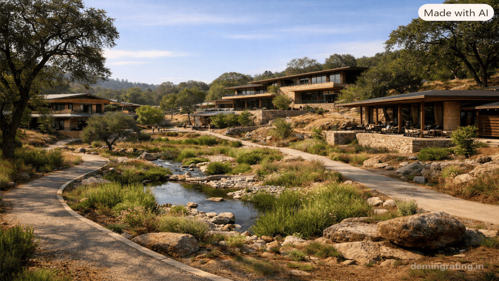
Strategies to Protect Natural Vegetation, Soil, and Landforms During Construction
Protecting natural vegetation, soil, and existing landforms during construction is an important part of sustainable site planning. Construction activities such as clearing, excavation, grading, equipment movement, and material storage can disturb ecosystems, compact soil, increase erosion, and alter natural drainage. A carefully planned construction process can minimise these impacts while preserving the ecological and physical characteristics of the site.
1. Identify and Map Sensitive Areas
Before construction begins, the site should be surveyed to identify mature trees, existing vegetation, natural drainage channels, steep slopes, exposed rocks, water bodies, sensitive habitats, and areas with valuable or erosion-prone soil. These features should be clearly marked on site plans and included within designated protection zones. The U.S. Environmental Protection Agency recommends identifying environmentally sensitive areas and establishing clear limits of disturbance before clearing and grading activities begin.
2. Establish No-Disturbance Zones
Protected areas should be physically separated from construction activity using temporary fencing, barriers, signage, or other visible markers. Construction vehicles, equipment, waste, and material storage should not be permitted within these zones. For mature trees, protection should extend around the root zone and, where appropriate, to the tree’s dripline. This helps prevent root damage and soil compaction.
3. Minimise Clearing and Grading
Only the area necessary for current construction activities should be cleared. Avoiding unnecessary excavation, filling, and levelling helps preserve natural landforms and reduces soil disturbance. Construction can also be planned in phases so that areas are cleared and developed progressively instead of exposing the entire site at once. Such staged development reduces erosion and sediment movement.
4. Protect and Reuse Topsoil
The nutrient-rich topsoil removed during unavoidable excavation should be separately stripped, stored, and protected from erosion and contamination. It can later be reused for landscape restoration and planting. Preserving native topsoil also reduces the need to import replacement soil. Construction guidance recommends preserving native topsoil where feasible and rehabilitating compacted areas before final planting.
5. Control Soil Erosion and Runoff
Temporary erosion-control measures such as mulch, erosion-control blankets, silt fencing, sediment barriers, temporary drainage channels, and rapid revegetation can help prevent exposed soil from being washed away. Natural vegetation should be retained wherever possible because established root systems help stabilise soil and existing vegetation can intercept rainfall and reduce runoff.
6. Prevent Soil Compaction
Heavy machinery can significantly compact soil, reducing its ability to absorb water and support vegetation. Dedicated access routes should therefore be established for construction vehicles, while traffic should be restricted in areas intended for landscaping or natural infiltration. Where unavoidable compaction occurs, soil should be appropriately loosened or rehabilitated before planting.
7. Protect Natural Drainage and Landforms
Natural slopes, depressions, drainage paths, and other landform features should be retained wherever practical. Altering these features can change water movement and increase erosion or flooding risks. Site planning should therefore work with existing contours rather than unnecessarily reshaping the entire site.
Conclusion
The most effective strategy is to protect first and restore second. By mapping sensitive features, establishing no-disturbance zones, limiting clearing, preserving topsoil, controlling erosion, preventing compaction, and retaining natural drainage and landforms, construction projects can significantly reduce environmental disturbance. These practices also support healthier landscapes after completion and contribute to responsible GGBC site planning.
#Biodiversity
How Does Natural Landscaping Support Biodiversity, Water Conservation, and Site Sustainability?
Natural landscaping is an important component of sustainable site planning because it works with local environmental conditions instead of relying heavily on artificial irrigation, intensive maintenance, or non-native ornamental planting. A well-designed natural landscape can provide habitat for wildlife, conserve water, improve soil performance, manage stormwater, and create a more resilient outdoor environment. These benefits make natural landscaping particularly relevant to GGBC site planning.
Supporting Biodiversity
Natural landscaping can significantly improve the ecological value of a developed site. Using a diverse selection of native or climate-adaptive plants provides food, shelter, and nesting opportunities for birds, butterflies, bees, and other organisms. Planting trees, shrubs, groundcovers, grasses, and flowering species at different heights can create multiple habitat layers and increase ecological diversity.
The GGBC guidance specifically recognises the importance of natural topography and vegetation in reducing long-term environmental impacts and promoting habitat and biodiversity. It also states that soft landscaping should not rely on monoculture planting and that native or adaptive vegetation is considered for the relevant site-planning criteria.
Conserving Water
Natural landscaping can reduce irrigation requirements by selecting plants that are suited to the local climate, rainfall, soil, and seasonal conditions. Native plants are often better adapted to regional conditions and can require less supplemental water once established. The U.S. Environmental Protection Agency recommends using regionally appropriate, low-water-use and native plants because they can require little additional water beyond normal rainfall.
Water conservation can be further improved through drip irrigation, mulching, rainwater harvesting, efficient irrigation scheduling, and the strategic reduction of high-water-use turf. Deep-rooted vegetation can also improve soil structure and infiltration, helping rainfall enter the soil rather than becoming rapid surface runoff.
Improving Site Sustainability
Natural landscaping contributes to broader site sustainability by protecting soil, reducing erosion, supporting stormwater management, and helping moderate local microclimate conditions. Vegetated areas can intercept rainfall, slow runoff, and provide opportunities for infiltration. Trees and vegetation can also provide shade and help reduce heat accumulation around buildings and paved areas.
Sustainable landscape design should therefore consider more than visual appearance. The selection of plant species, soil preparation, irrigation strategy, drainage, maintenance requirements, and relationship with existing natural features should all be considered as part of an integrated site design. The U.S. EPA also identifies permeable surfaces, climate-appropriate plants, integrated pest management, and low-emission landscape equipment among greener landscaping approaches.
Conclusion
Natural landscaping supports GGBC objectives by creating a healthier relationship between the built environment and the natural site. Biodiversity is supported through diverse native and adaptive vegetation; water is conserved through climate-appropriate planting and efficient irrigation; and overall site sustainability is improved through better soil protection, stormwater management, habitat creation, and reduced maintenance demands.
For projects seeking compliance, the applicable rating-system version should be reviewed carefully because criteria and thresholds can change between versions. The official Green New Buildings resources provide current rating-system information and related documentation.
#LandscapeArchitecture
What Are the Benefits of Integrating Natural Topography and Landscape into GGBC Building Design?
Integrating natural topography and landscape into building design means responding to the site’s existing terrain, vegetation, soil conditions, drainage patterns, and ecological features instead of substantially altering them to accommodate the development. This approach is an important principle of sustainable site planning because it can reduce environmental disturbance while improving the functional, ecological, and visual quality of a project. For GGBC projects, considering natural site characteristics from the earliest stages of design can contribute to more efficient and environmentally responsive buildings.
1. Reduced Site Disturbance
One of the primary benefits is reduced disturbance to the existing land. Designing around natural contours can minimise extensive excavation, filling, grading, and levelling. This helps preserve soil structure, existing vegetation, natural drainage patterns, and geological features. Reducing the amount of earthwork can also lower the environmental impacts associated with transporting and disposing of excavated material.
2. Better Stormwater Management
Natural landscapes can play an important role in managing rainfall. Vegetated areas and undisturbed soils can slow surface runoff and promote infiltration. Maintaining natural depressions, slopes, and drainage routes can therefore help the site manage stormwater more effectively. The U.S. Environmental Protection Agency identifies natural features and green infrastructure as useful tools for managing runoff, reducing flooding impacts, and improving water quality.
3. Improved Biodiversity
Retaining existing trees, vegetation, rocks, and other natural features can preserve habitat that might otherwise be lost during development. Supplementing retained vegetation with native or adaptive plant species can further strengthen ecological value. GGBC’s green-building approach recognises natural topography and appropriate vegetation as important considerations for reducing environmental impact and promoting habitat and biodiversity.
4. Water Conservation
Landscape design based on local climatic conditions can reduce irrigation requirements. Selecting native or adaptive plants, limiting high-water-use turf, using mulch, and incorporating efficient irrigation systems can help reduce landscape water demand. Climate-appropriate landscaping can also remain healthier with less maintenance and supplemental irrigation once plants become established. The U.S. EPA’s WaterSense programme provides guidance on water-efficient landscaping and appropriate plant selection.
5. Improved Microclimate and Outdoor Comfort
Trees and vegetation can provide shade and help moderate outdoor temperatures. Strategically positioned landscape elements can shade pedestrian areas, courtyards, façades, and other heat-exposed spaces. Vegetation can also contribute to evapotranspiration and improve the comfort of outdoor environments. This makes landscape planning relevant not only to ecological performance but also to the usability of the site.
6. Greater Design Integration
Working with existing topography can produce architecture that responds naturally to its surroundings. Buildings can follow site contours, outdoor spaces can be arranged around existing vegetation, and pathways can be aligned with natural movement patterns. Rather than treating landscape as an afterthought, this approach creates a stronger relationship between architecture and the site.
7. Potential Resource and Maintenance Benefits
Preserving existing landscape features can reduce the need for extensive landscape reconstruction after construction. Similarly, appropriate plant selection can reduce long-term irrigation, fertiliser, pruning, and replacement requirements. These factors can contribute to lower operational demands over the life of the landscape.
Conclusion
Integrating natural topography and landscape into GGBC building design can provide environmental, functional, and aesthetic benefits. Reduced land disturbance, improved stormwater management, biodiversity protection, water conservation, better microclimate conditions, and stronger architectural integration are among the key advantages.
The most effective approach is to conduct a detailed site assessment before design development and identify which natural features can be retained and incorporated into the building and landscape strategy. Project teams should also verify the requirements of the applicable GGBC rating-system version because criteria and documentation requirements may be updated over time.
#GreenBuilding
Case Study of Natural Topography and Landscape
A practical example of integrating natural topography and landscape into building design can be seen in Gaia Hills, Pawana, Maharashtra. The project is located within the Sahyadri landscape and covers approximately 60 acres of rolling hills, forest groves, a perennial river, seasonal water channels, flat land, lakes, and trails. Rather than treating these natural features as constraints, the project has been planned around the existing ecological and topographical conditions. The design team includes landscape, forestry, permaculture, civil, and engineering expertise, allowing the development to follow a broader landscape-led approach.
Understanding the Existing Site
The first important lesson from Gaia Hills is the value of conducting a detailed site assessment before determining the location of buildings and infrastructure. The site’s existing slopes, vegetation patterns, water channels, and microclimatic conditions influence where different activities are located. The master plan places residential, community, and experiential spaces at suitable points while maintaining a strong relationship with the surrounding landscape.
Working With Natural Contours
Instead of creating a uniform development platform through extensive cutting and filling, the project uses the natural contours of the land to guide the placement of buildings and pathways. Trails and circulation routes follow the site’s natural form, helping connect different areas while maintaining the character of the terrain. This approach demonstrates how topography can become a design tool rather than simply an engineering challenge.
A similar principle can be observed in the Aranya Housing Project in Indore, where site topography influenced the planning of roads and service networks. The development used the terrain to maximise gravity flow and minimise unnecessary cut-and-fill operations. This demonstrates how understanding natural levels at the planning stage can provide both environmental and infrastructure benefits.
Integrating Landscape With Water Management
Natural landscape planning is particularly important for managing rainfall and surface water. Existing drainage channels, low-lying areas, and natural slopes can help determine how stormwater moves through a site. Instead of immediately replacing these systems with extensive artificial drainage, designers can integrate them into the landscape strategy where technically appropriate.
A contemporary example is the Farmhouse in Kamshet, Maharashtra, where the landscape design uses the site’s natural topography and monsoon water flow. Lower-lying portions of the property have been transformed into paddy fields, while a forest plantation near the entrance acts as a buffer from the highway. The project demonstrates how natural landform and water movement can become functional components of the landscape rather than obstacles to construction.
Key Lessons for GGBC Site Planning
These case studies demonstrate several principles applicable to natural topography and landscape planning:
- Conduct a detailed topographical and ecological site assessment before design.
- Retain existing trees, vegetation, water channels, and significant landforms wherever feasible.
- Minimise unnecessary excavation, filling, and grading.
- Align buildings and circulation routes with existing contours.
- Use natural drainage patterns to inform stormwater strategies.
- Select native or climate-adaptive vegetation.
- Integrate landscape, water management, architecture, and infrastructure from the beginning.
- Document retained natural features and landscaped areas clearly for project assessment.
The main lesson is that sustainable site planning does not necessarily require creating an entirely new landscape. The most environmentally responsive approach is often to understand what already exists and allow the building and landscape design to evolve around those natural systems.
#SustainableSitePlanning
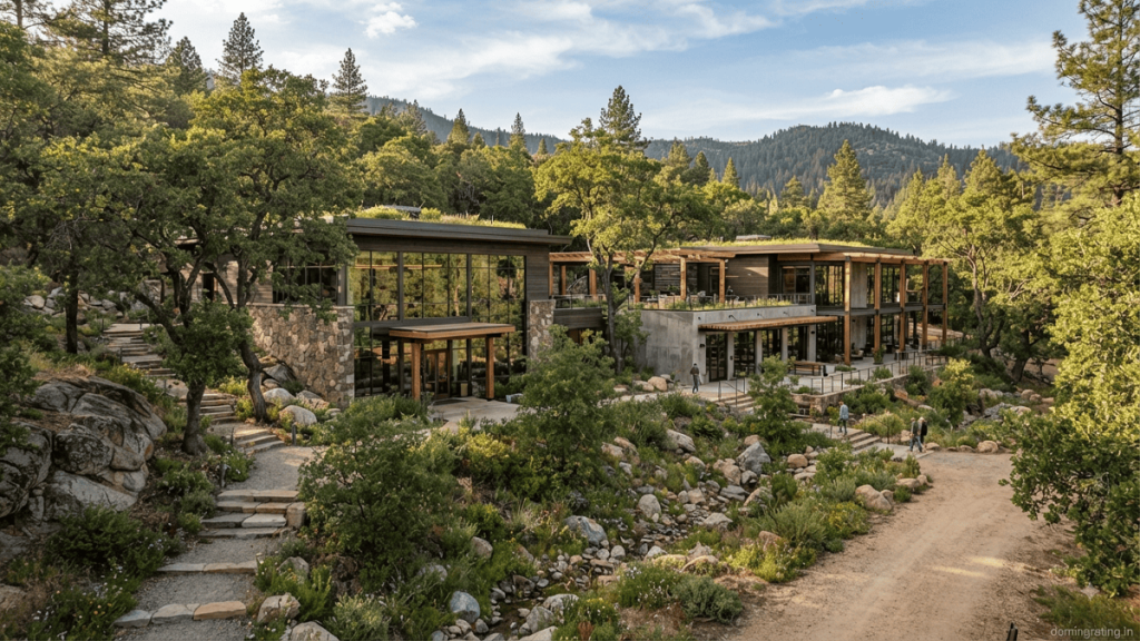
White Paper on Natural Topography and Landscape
Executive Summary
Natural topography and landscape are fundamental components of sustainable site planning. Rather than treating the existing terrain, vegetation, soil, and water features as obstacles to construction, an environmentally responsible design approach considers them as resources that can guide the planning and development process. Preserving natural landforms and integrating appropriate vegetation can reduce site disturbance, support biodiversity, improve stormwater management, conserve water, and create more resilient outdoor environments.
For green-building projects, natural topography and vegetation are specifically recognised within site-selection and planning criteria. The current Green New Buildings resources identify natural topography and/or vegetated ground areas as a strategy for minimising disturbance and promoting habitat and biodiversity. The published criteria also distinguish natural features such as exposed rocks and water bodies and encourage native or adaptive vegetation rather than monoculture planting.
1. Introduction
Rapid urbanisation often transforms natural landscapes through extensive excavation, grading, vegetation removal, soil compaction, and construction of impervious surfaces. While these interventions may simplify construction, they can also disrupt ecological processes and alter the natural hydrological behaviour of a site.
Natural topography refers to the existing physical characteristics of land, including contours, slopes, depressions, exposed rock formations, natural drainage patterns, and water bodies. Natural landscape includes existing vegetation, soil systems, habitats, and other ecological features.
A sustainable site-planning strategy begins with understanding these characteristics before deciding where buildings, roads, parking areas, utilities, and recreational spaces should be located. This allows the project to minimise unnecessary disturbance and use the site’s existing characteristics to improve environmental performance.
2. Importance of Preserving Natural Topography
Preserving natural landforms can reduce the requirement for extensive cut-and-fill operations. Excessive grading can disturb soil layers, increase erosion, modify drainage patterns, and require additional construction resources.
Working with existing contours can also help buildings and circulation networks respond more naturally to the site. Sloping sites, for example, may allow stepped building forms, terraced landscapes, or contour-sensitive pathways rather than requiring the entire property to be levelled.
Natural landforms can also contribute to stormwater management. Existing slopes, depressions, and vegetated areas influence how rainfall moves across a property. Retaining these features can support infiltration and reduce the concentration of surface runoff when combined with appropriate drainage and landscape design.
3. Landscape and Biodiversity
Vegetation is an important ecological component of the site. Mature trees, shrubs, groundcover, grasses, and other plants can provide food and shelter for birds, insects, and other organisms. A diverse landscape can therefore provide greater habitat value than a landscape dominated by a single ornamental species.
The green-building criteria for natural topography and vegetation specifically state that soft landscaping should not be designed as monoculture because monoculture does not promote habitat and biodiversity. They also identify native or adaptive vegetation as eligible for the relevant calculation.
Consequently, landscape design should prioritise species that are suited to local climatic and soil conditions. Plant selection should consider water requirements, ecological value, maintenance needs, seasonal behaviour, and compatibility with existing vegetation.
4. Water Conservation and Stormwater Management
Natural landscaping can contribute to water conservation when plant species are selected according to local climate and rainfall conditions. Native and adaptive plants generally provide a more appropriate basis for low-water landscapes than species requiring intensive irrigation.
Water-efficient landscape design can incorporate drip irrigation, mulching, rainwater harvesting, appropriate soil preparation, and efficient irrigation scheduling. The objective should be to provide adequate water for plant establishment and health without creating unnecessary demand for potable water.
Natural ground conditions also have an important role in stormwater management. Vegetated soil can intercept rainfall, reduce runoff velocity, and provide opportunities for infiltration. Protecting natural drainage patterns can complement engineered drainage systems and improve the site’s overall resilience during heavy rainfall.
5. Construction-Phase Protection
Preservation must begin before construction starts. A site assessment should identify trees, natural vegetation, water bodies, drainage channels, exposed rocks, sensitive habitats, and other features that should be retained.
Protection zones should then be established around sensitive areas. Construction traffic, material storage, waste, and temporary facilities should be kept outside these zones. Unnecessary clearing and grading should be avoided, while topsoil removed during essential excavation should be protected for later landscape restoration.
Construction activities should also include erosion and sediment controls. Measures such as temporary barriers, mulch, erosion-control blankets, controlled drainage, and timely revegetation can help prevent soil from being transported away from disturbed areas.
6. Integrating Landscape With Building Design
The most effective approach is to integrate landscape planning into architectural design from the beginning. Building orientation, site access, pedestrian routes, parking, utilities, and outdoor spaces should be evaluated together with existing topography and vegetation.
Instead of designing the building first and landscaping the remaining spaces afterward, the project team can use natural features to influence the building footprint and site layout. This can create stronger connections between indoor and outdoor spaces while reducing unnecessary environmental disturbance.
Landscape elements can also improve outdoor comfort by providing shade and supporting more pleasant microclimatic conditions. Trees and vegetation can be strategically positioned around pedestrian routes, courtyards, gathering spaces, and heat-exposed areas.
7. Recommended Implementation Framework
A practical natural-topography and landscape strategy can follow six stages:
- Site assessment: Prepare detailed topographical, ecological, vegetation, soil, and drainage surveys.
- Feature identification: Map valuable natural features and environmentally sensitive areas.
- Development planning: Position buildings and infrastructure to minimise disturbance.
- Landscape strategy: Prioritise native or adaptive vegetation and diverse planting.
- Construction protection: Establish no-disturbance zones and implement erosion and soil-protection measures.
- Post-construction monitoring: Verify landscape establishment, irrigation performance, drainage, and retained natural features.
Documentation should include site plans, area calculations, landscape drawings, photographs, planting schedules, and relevant construction records as applicable to the project’s rating-system requirements.
8. Key Benefits
Integrating natural topography and landscape can provide multiple benefits:
- Reduced excavation and site disturbance
- Protection of existing ecological features
- Improved habitat and biodiversity
- Better stormwater management
- Reduced soil erosion
- Lower landscape water demand
- Improved outdoor thermal comfort
- Reduced landscape maintenance requirements
- Stronger integration between architecture and the surrounding environment
- Greater long-term site resilience
These benefits demonstrate that landscape sustainability should not be viewed solely as an aesthetic consideration. It is an important component of environmental performance and responsible land development.
Conclusion
Natural topography and landscape provide an opportunity to create buildings that are more responsive to their environmental context. Preserving existing landforms, protecting vegetation, maintaining natural drainage, and selecting climate-appropriate plants can collectively reduce the ecological impact of development.
The fundamental principle is simple: understand the site before changing it. When architects, landscape designers, engineers, and developers collaborate from the beginning, natural features can become part of the project’s functional design rather than being removed and recreated artificially.
For projects pursuing green-building certification, the applicable current rating-system requirements should always be verified before making compliance claims. The official Green New Buildings resources currently identify Version 4.0 as the applicable version for projects applying for precertification or certification from May 1, 2026, while projects registered earlier under Version 3 have specific transition provisions.
#SustainableLandscape
Industry Application of Natural Topography and Landscape
Natural topography and landscape have applications across a wide range of industries, including commercial real estate, manufacturing, residential development, hospitality, healthcare, education, infrastructure, and large institutional campuses. Instead of treating landscape as a decorative element, modern sustainable development increasingly considers existing terrain, vegetation, soil, drainage, and ecological features as integral parts of project planning.
The application of these principles is particularly relevant to green-building projects because site planning can influence construction impacts, water management, biodiversity, outdoor comfort, and long-term maintenance requirements. The current green-building framework for new buildings includes natural topography or vegetation as a specific site-selection and planning consideration.
1. Commercial and Corporate Buildings
In commercial developments, natural topography can guide the location of buildings, pedestrian pathways, parking areas, and landscape zones. Instead of extensively levelling a site, designers can position buildings according to existing contours. Existing trees and vegetation can be incorporated into courtyards, pedestrian areas, and outdoor seating spaces.
This approach can reduce unnecessary excavation and help create shaded outdoor environments. Landscape planning can also contribute to stormwater management by retaining vegetated areas and allowing appropriate infiltration.
2. Industrial and Manufacturing Facilities
Industrial projects generally require substantial infrastructure, making early site planning particularly important. Factories and manufacturing facilities can use topographical surveys to determine efficient building platforms while minimising unnecessary cut-and-fill operations.
The green-building rating framework for factory buildings is designed specifically for industrial facilities and addresses environmental performance, water efficiency, energy efficiency, and healthier working environments.
Landscape buffers can also be introduced around industrial sites to separate operational areas from surrounding communities, improve visual quality, and support local ecological conditions.
3. Residential Development
Residential projects can integrate existing vegetation, slopes, and natural drainage features into housing layouts and common open spaces. Natural landscapes can provide shaded walking routes, recreational areas, community spaces, and habitat.
For large residential developments, retaining existing trees and establishing diverse plant communities can reduce the environmental impact of site transformation. It can also create more attractive and comfortable outdoor spaces for residents.
4. Hospitality and Resort Projects
Hotels and resorts often benefit significantly from landscape-led planning because the surrounding environment is an important part of the guest experience. Resorts can preserve natural hills, forests, water bodies, and existing vegetation while placing buildings and recreational facilities around these features.
Rather than replacing the landscape with intensive ornamental planting, designers can use the existing terrain to create walking trails, viewpoints, gardens, water-sensitive landscapes, and outdoor gathering spaces.
5. Educational and Institutional Campuses
Large campuses provide an excellent opportunity to integrate architecture and natural landscape. Academic buildings can follow existing contours, while green corridors and pedestrian routes connect different parts of the campus.
A recent example is the planned IIM Bangalore campus at Jigani, where the site’s undulating terrain, natural water channels, and existing tree groves have influenced the planning approach. The significant level difference across the site has contributed to a stepped architectural language intended to reduce excessive cut-and-fill and create shaded terraces.
6. Urban and Public Infrastructure
Natural topography and landscape principles are also applicable to roads, public spaces, transportation facilities, and urban infrastructure. Vegetated areas, drainage corridors, green buffers, and permeable surfaces can help manage stormwater and reduce the environmental impact of hardscape-heavy development.
The Central Public Works Department recommends analysing factors such as soil, hydrology, existing vegetation, wind direction, and slopes during landscape planning. Its guidance also emphasises protecting landscape during construction, conserving soil, reducing hard paving, and reducing landscape water requirements.
7. Construction and Project Management
Application begins before construction. Site teams should identify trees, sensitive vegetation, natural drainage channels, soil areas, slopes, and other features that need protection. Clearly defined protection zones can prevent construction traffic and material storage from damaging retained landscape.
Topsoil should also be preserved where feasible and reused during landscape development. TERI recommends protecting existing vegetation and mature trees, preserving nutrient-rich topsoil, and using measures such as contour trenching and mulching to reduce erosion and runoff.
Conclusion
The industry application of natural topography and landscape extends far beyond aesthetic landscaping. It influences site planning, architecture, construction, stormwater management, biodiversity, water conservation, outdoor comfort, and long-term operational performance.
The most effective approach is to integrate landscape professionals, architects, civil engineers, environmental consultants, and project managers from the early design stage. By understanding the site’s existing characteristics before construction begins, projects can reduce unnecessary land disturbance and create development that responds more effectively to its environmental context.
#NaturalTopography
Ask FAQs
What is natural topography in sustainable building design?
Natural topography refers to the existing physical characteristics of a site, including slopes, contours, natural depressions, exposed rocks, water bodies, and other landforms. In sustainable building design, preserving these features helps minimise excavation, grading, soil disturbance, and changes to natural drainage patterns. Designing buildings and infrastructure around existing terrain can create a more environmentally responsive development.
Why is preserving existing vegetation important?
Existing vegetation, particularly mature trees and native plant communities, provides habitat for birds, insects, and other organisms while helping stabilise soil and reduce surface runoff. Vegetation can also provide shade and contribute to improved outdoor comfort. Retaining existing plants where feasible can reduce the need for extensive landscape restoration and support the ecological character of the site.
How does natural landscaping help conserve water?
Natural landscaping uses plant species that are appropriate for the local climate, soil, and rainfall conditions. Native or adaptive plants can reduce dependence on irrigation once established. Water conservation can be further improved through drip irrigation, mulching, rainwater harvesting, efficient irrigation scheduling, and limiting high-water-use turf. The U.S. EPA WaterSense landscaping guidance provides additional information on water-efficient landscape practices.
How can natural topography help manage stormwater?
Existing slopes, vegetation, soil, and natural depressions influence how rainfall moves across a site. Preserving these features can slow runoff, promote infiltration, and reduce the amount of water entering conventional drainage systems. Combining natural features with appropriate stormwater infrastructure can improve overall site resilience and help reduce erosion and localised flooding.
What should be considered when planning natural topography and landscape for a green-building project?
The project team should assess existing terrain, vegetation, soil conditions, drainage patterns, water bodies, and ecologically sensitive areas before finalising the site plan. Buildings, roads, parking, and utilities should be positioned to minimise unnecessary disturbance. Construction protection measures, topsoil preservation, native or adaptive planting, efficient irrigation, and appropriate documentation should also be considered. For project-specific requirements, refer to the official Green New Buildings resources and verify the applicable rating-system version and criteria.
Table of Contents
Disclaimer: Natural topography and landscape strategies should be adapted to site conditions, local regulations, and project requirements. Professional assessment is recommended before implementation.